Next to Seaplane Lagoon and the San Francisco Bay sits the Bay Area's Alameda Point at the west end of Alameda Island. The three-acre waterfront park is part of the revitalization at the former Alameda Naval Air Station. Alameda Point Partners, APDW, BAR Architects, and BKF Civil Engineers prepared the Development Plan, which was endorsed by the Greenbelt Alliance as a “prime example of sustainable, equitable, transit-oriented development”. The mixed-use master plan, responsive to sea level rise, will create a walkable and transit-friendly new community. It will include approximately 14 acres of open space with local retail opportunities, office spaces, and four major parks. The design process involved public meetings and comments from The Planning Board and the Recreation and Park Commission.
APDW - Rendering
Taxiway entry
View from the Bay

APDW - Phases masterplan
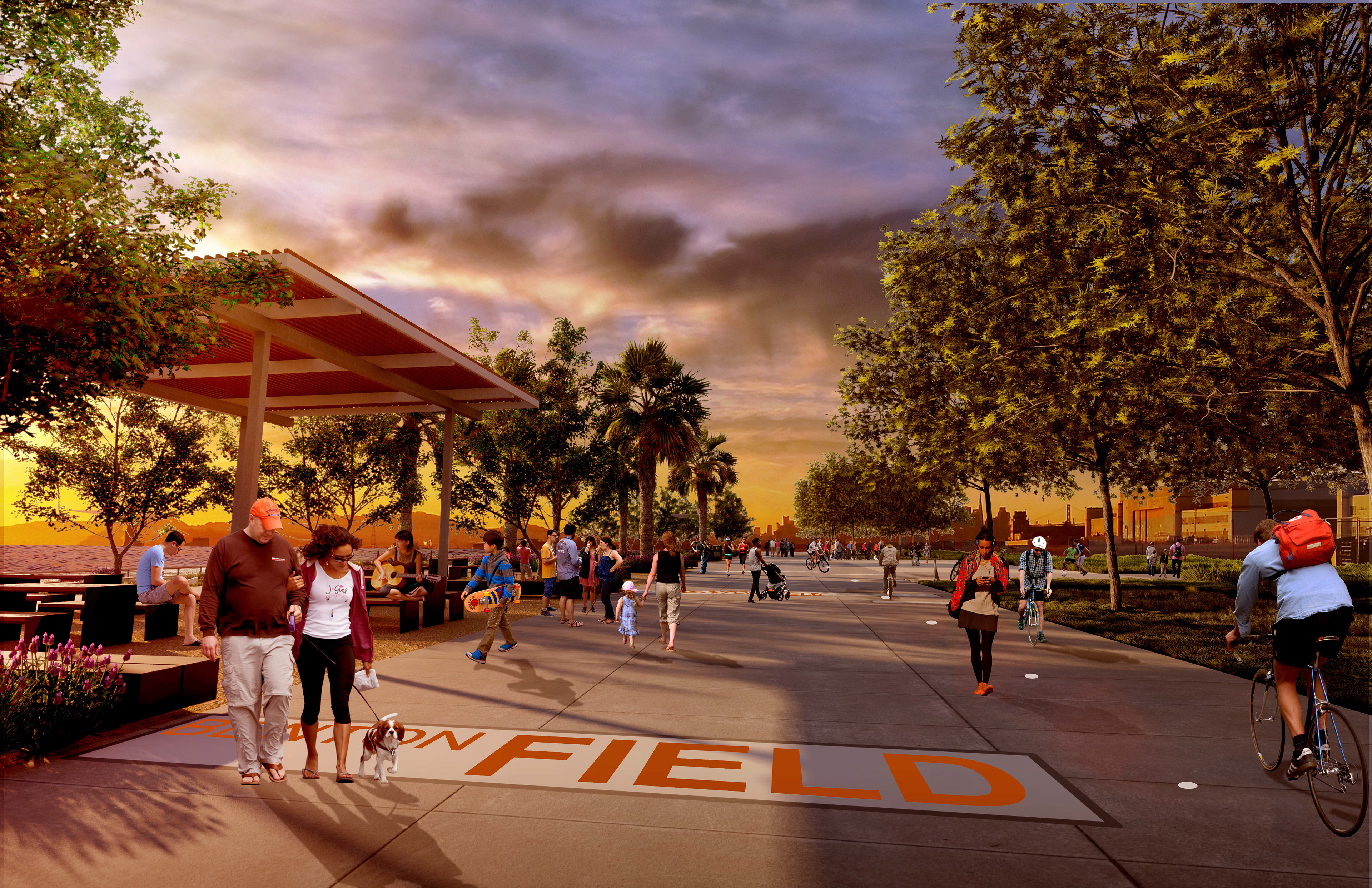
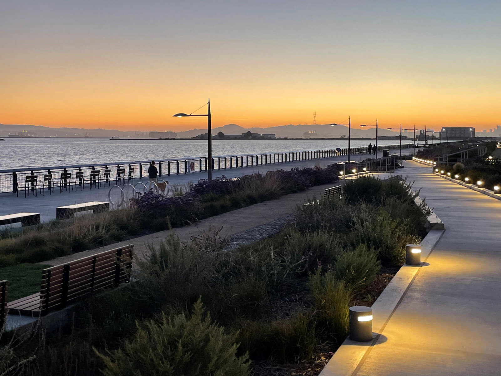
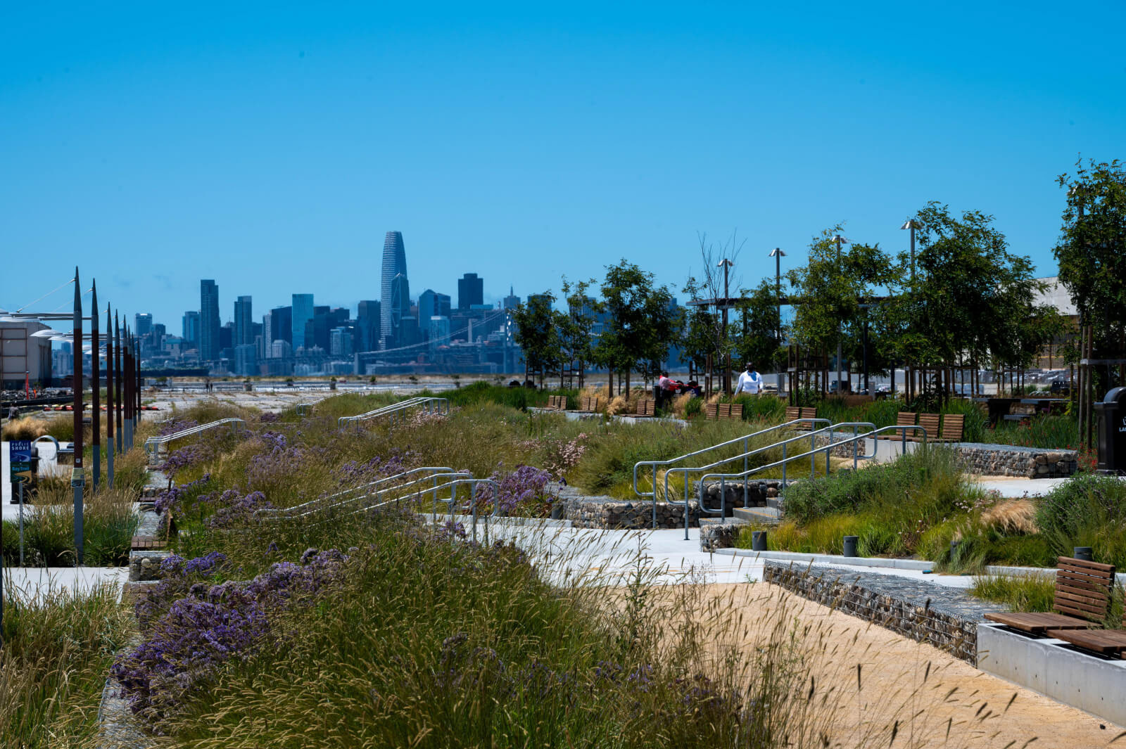
The first of these parks, the Waterfront Park Phase 1, will be located directly on the historic Seaplane Lagoon. The design of the Waterfront Park engages with the public through three distinct areas. The entry to the park has an overlook directed towards the spectacular views of the USS Hornet and Bay Bridge with San Francisco beyond. The “Taxiway” aligns with the view corridor to San Francisco and will provide flexible space for events and intimate gatherings. Visitors approach the Seaplane Lagoon by way of a series of paths through planted terraces. Once they reach the promenade along the water, they find many places to sit, stroll, and enjoy the tremendous views. Phase 1 Waterfront Park was completed in 2022.

APDW - Proposal

APDW - Sea level diagram

APDW - Sea level diagram
With anticipated sea level rise, the existing taxiways will flood. Consistent with the approved MIP and San Francisco Bay Conservation and Development Commission (BCDC) policies, the Phase 1 Waterfront Park is designed to address 24 inches of sea level rise and additional sea level rise in future years beyond 24 inches through adaptive management strategies.
Additionally, the sea level rise strategy is designed around a series of short terraces spread over a larger space to minimize the impression of elevation changes. This approach also allows for the preservation of the existing bulkhead, which is a character-defining feature of the Historic District. During storm events and “King Tides” (unusually high tides), the bulkhead and adjacent promenade will flood occasionally as the sea level rises over time, but major portions of the public park and Bay Trail will remain above the flooded areas behind the stepped terraces. As such, the design balances the competing needs to address sea-level rise, preserve the bulkhead, and maintain the horizontality of the site.
Landscaped terraces